Map & Directions
Find your way to Shadowcliff’s mountain sanctuary overlooking Grand Lake.
Perched on a rocky outcropping above the water and within walking distance of Rocky Mountain National Park, Shadowcliff is a quiet retreat with some of the best views in Grand Lake.
Below you’ll find directions from both east and west, plus tips to help you navigate our hillside campus.
About Grand Lake
Grand Lake, the western gateway to Rocky Mountain National Park, is a delightful, historic town with a 4-block boardwalk shopping district. The beach area provides a place for kids to play and adults to relax. Boats can be rented. And of course, there is hiking, with three trailheads into RMNP starting in Grand Lake. If you’ve already experienced Grand Lake, you know how wonderful it is. If this is your first visit, you’ll probably be back!
Shadowcliff at a Glance
- Elevation: 8,400 ft
- Distance to town: ~10-minute walk downhill
- Distance to RMNP North Inlet & Tonahutu trailheads: ~0.2 miles
- Season: Open June–September
Shadowcliff’s campus includes lodges, cabins, gathering spaces, an interpretive trail, and a signature viewpoint we call The Point — a beautiful place for contemplation, gatherings, or sunset watching.
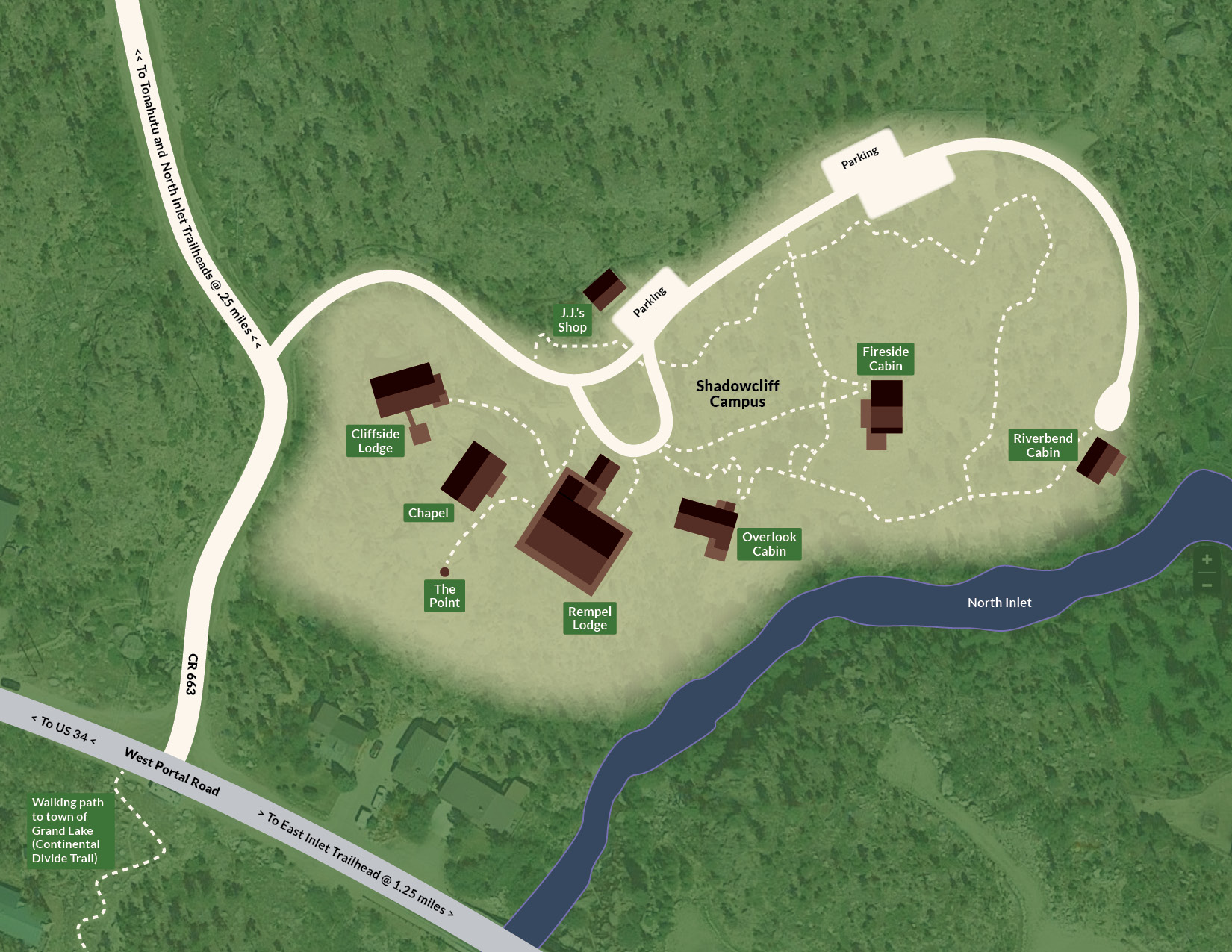
Exploring the Shadowcliff Grounds
Much of Shadowcliff sits atop a forested ridge overlooking Grand Lake. The terrain includes stairs, stone paths, and uneven ground.
During your stay, we invite you to enjoy:
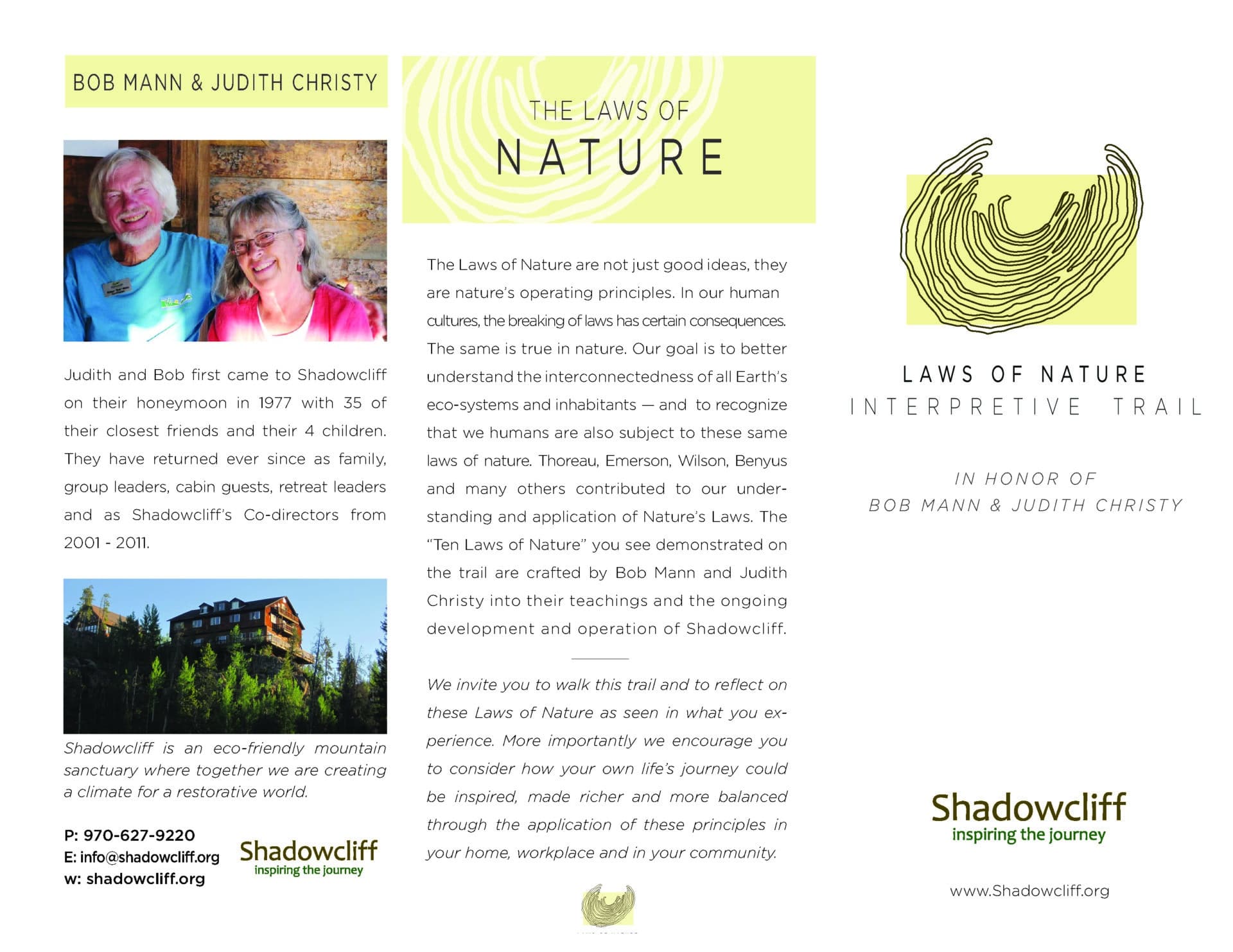
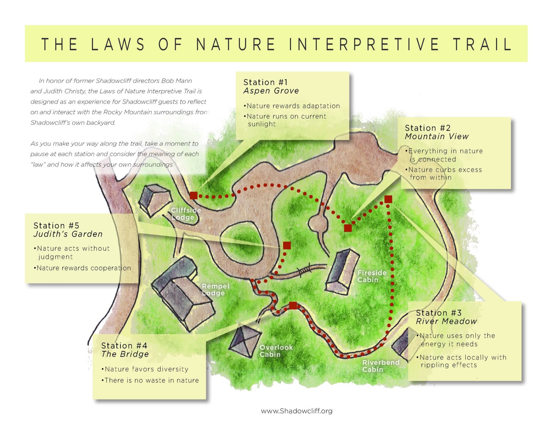
Laws of Nature Interpretive Trail
A short, contemplative loop with five interpretive stops, each offering a prompt for reflection and a scenic view.
North Inlet Stream
Follow the road downhill to reach the rushing creek that borders our lower property.
The Point
Our most beloved viewpoint — a circle of natural rock seating with sweeping views of the lake, mountains, and sky. A perfect place to watch the sunrise or sunset, sit in quiet contemplation, or hold an opening or closing ceremony.

DOWNLOAD CAMPUS MAP
Getting to Shadowcliff
- Take I-70 West → Exit onto Hwy 40 toward Winter Park. (This route goes over Berthoud Pass at 11,306 feet.)
- In Granby, turn right onto US Hwy 34 toward Rocky Mountain National Park.
- Continue ~15 miles into Grand Lake.
- Just after the Conoco station, turn right into Grand Lake onto West Portal Road.
- At Mountain Market, turn left at the fork at Veteran's Park to stay on West Portal Road.
- Drive ~1 mile, then turn left on County Road 663.
- Follow the hill up until you see the sign for Shadowcliff Mountain Lodge on your right.
Alternative: If you prefer to avoid Berthoud Pass, exit I-70 at Hwy 9 in Silverthorne/Dillon → head north → connect to Hwy 40 → then Hwy 34.
- Take Hwy 34 west through Rocky Mountain National Park. Passes and timed-entry permits may be required—visit www.nps.gov/romo/planyourvisit for more info
- After passing the Alpine Visitor Center, descend toward the Kawuneechee Valley.
- Exit the Park near the Kawuneechee Visitor Center.
- Continue ~1 mile to the turn into Grand Lake onto West Portal Road.
- At Mountain Market, turn left at the fork at Veteran's Park to stay on West Portal Road.
- Stay left for ~1 mile → turn left onto County Road 663.
- Look for the Shadowcliff sign on your right.
NOTE: Trail Ridge Road is typically open late May through September and may close without notice due to weather.
Ready to Start Your Journey?
The Laws of Nature Trail
